What's better: a smartphone or a GPS navigator? What is the difference between a navigator and a smartphone with a GPS receiver?
Is the GPS module in a smartphone as accurate as the GPS module in a separate navigator or not?
Yes, the receivers (or rather, the GPS chip) are the same.
The phone can determine its position via Wi-Fi, telephone networks etc.
The only thing that bothers me is that the phone has A-GPS and it determines the location in the first seconds via GSM networks, they say that it eats up 5-7 kilobytes of traffic, but in roaming this can cost a lot of money, because in the end these are 5-7 kilobytes after the end of the session rounded up to 100kb
this is called hello increased battery and traffic consumption)))) I don’t argue that with GPRS turned on, the location is found faster and more accurately...
In HTC you can forcefully mute GPRS connections while roaming.
I used IGO from my phone for walking routes around Paris. No withdrawals of money for GPRS traffic were noticed))))
This A-GPS- this is not a replacement for GPS, but an auxiliary technology for a quick cold start (immediately after turning on the receiver to determine your coordinates). It receives a signal from the base stations of a cellular operator, via an alternative channel (service) and is not connected to Internet traffic (3G, EDGE, GPRS), and, moreover, it does not matter at all whether you are roaming or not. It receives this signal in any case and the base stations know where the phone with a certain IMEI and SIM card is located. The accuracy depends on the number of simultaneously “visible” base stations (the more the better). When the radio module is turned off, it does not work.
Let’s say I have an HTC Legend and have never had any problems searching for satellites... and a friend sitting next to me in the car with his Nokia was constantly forced to reach out to the windshield))))
And this is where different chips come into play.
In the case of VinMOBO, smart phones already have Win6.5 or Win7, and navigators often have WinCE => you can install more on a smart new version programs
1.Windows Mobile (latest 6.5.3),
2.Windows Phone 7,
3.WindowsCE (5 or 6)
Generally different operating systems. WinCE is a special operating system for embedded systems. According to the version navigation programs There are different ones available for these three operating systems listed above, plus you can add Android, Apple IOS, Bada, Symbian to them. Some software manufacturers (for example, Navitel) are not willing to update their programs for WinCE. Sometimes new maps (more complete) require new versions of the program and then owners of pure navigators are left without updates (Navitel again).
+ you can install several navigation programs on a smart device (CityGID, iGO, Navitel, Garmin, ...), unlike a navigator, which in most cases is “tailored” to one program (and it’s good if it’s something common, but not some Ketai crap where maps are updated every 1-2 years)Minuses:
- during calls, the navigation program is minimized and it is not clear where to go. You have to either stop and talk on the phone or drive at random. Here, IMHO, you need to estimate how often you talk on the phone, in particular on long trips/travels (I think that when roaming, few people talk for an hour or 2-3 a day, but for a conversation of 2-3 minutes with relatives, you can slow down or call back later)
- back side one device. If your smart account dies, you will have neither a phone nor a navigator.
absolutely agree, 200%
BUT there is one condition when using the navigator - DO NOT TURN OFF YOUR HEAD.
1000000%
Based on everything said and commented above, I would choose a communicator on Android. I actually got myself an Android tablet, but that’s another story (like a laptop or navigator)
Once upon a time, GPS navigators replaced simple paper maps. And then, completely unnoticed and somehow even quietly, the ubiquitous smartphones began to conquer the market.In 2014 alone, about 1.2 billion smartphones were sold worldwide. These are staggering numbers that should make GPS navigators' electronic hairs stand on end. A logical question arises: is a smartphone preferred to other gadgets because it is better? Or is it simply more widely used due to its rich functionality? So, let's figure it out. What is better to use as a car road sign - a traditional GPS tracker or a dear smartphone, without which modern man feels naked?
What to prefer - a smartphone or a GPS navigator?
Photo extremetech.com
Satellite signals
In the 1970s US Department of Defense ordered development what we today call a global positioning system, which has a constellation of 24 satellites. Around the same time, Russia began to develop its own network, called GLONASS. By the way, in December 2006, negotiations took place at which the Russians and Americans agreed that the systems GLONASS and GPS will complement each other.
To use a positioning system, until recently, motorists needed a special device that could skillfully process GPS signals. But today the situation has changed: almost all new smartphones can receive such signals, process them and almost instantly track location with great accuracy. It would seem - what is the difference? She is. And the main ace in the sleeve of smartphones is Assisted GPS. This technology allows for faster cold start of GPS receivers.
 GPS and GLONASS systems make our lives easier
Photo to patriotam.rf
This unique feature mobile phones allows the device to use real-time information provided by towers mobile operators. This way, the person driving can determine their coordinates much faster. Some mobile applications that use the phone’s built-in phone also help in this case. accelerometer and digital compass for more accurate location determination.
Map data
Most important information any Navigation tools are maps. It must be admitted that many GPS trackers, especially those that cannot access the Internet, are equipped with a very meager set of pre-installed maps. Updating such data often involves many technological difficulties. In addition, do not forget about the additional financial burden. When using a smartphone, this problem is not so acute, although there are pitfalls here too.
 Many cars are equipped with standard GPS systems that fully satisfy the needs of drivers
Photo fastcompany.net
The main thing is the price of the issue. When it comes to additional expenses, the smartphone causes The GPS navigator is hit below the belt. While the cost of software installed on GPS systems can be quite hefty, smartphone maps can be obtained absolutely free. And if not free, then practically for pennies. There are tons of navigation apps that can be installed on your smartphone in seconds. And such maps are not only not inferior to the data provided by GPS navigators, but can also give them a head start. In addition, smartphones easily geotag photos. Some GPS navigators are also capable of this kind of magic, but it costs the user a pretty penny.
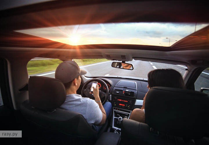 A smartphone without special accessories can become a serious distraction
Photo pexels.com
Many mobile navigation apps allow you to share location information, waypoints, and routes within in social networks, or store this information in the “cloud”, from where other users can “retrieve” it. Try this using your GPS device.
Device cost
If we are already talking about price, it is worth noting that many users claim that the GPS navigator costs much less than a smartphone. However, the price of a gadget is a very, very conditional factor. Electronics manufacturers have long begun to fill different market niches, which is why today you can find both smartphones and GPS trackers playing in different price leagues. Motorists have the opportunity to buy a completely decent navigation system at an affordable price, or get a budget smartphone that will be an excellent guide through cities and villages.
 Today the cost of a gadget is not a factor
Photo phonearena.com
Internet access
The ability to connect to the World Wide Web is an important component of comfortable driving in unfamiliar areas. Many GPS navigators, but not all, today are equipped with this function. However, as a rule, they are not cheap. But for a smartphone, accessing the Internet is as natural as breathing is for us. This feature allows you to download new maps and updates in real time, get traffic and POI data, and much more.
 Internet access is a huge advantage of a smartphone
Photo today.mts.com.ua
The advantage of the filling
No one will argue that the performance of smartphones is usually an order of magnitude higher than the capabilities provided by a GPS navigator. More modern software and high-performance hardware again bring smartphones forward.
 The smartphone has more impressive capabilities
Photo: gnsystems.net
Accessories
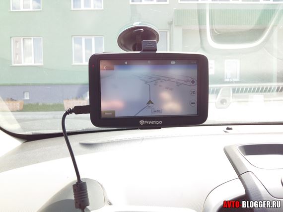
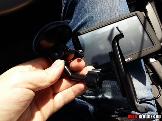
All navigators are equipped with such necessary necessary things, like a car charger and a special mount that allows you to place the device in the car in such a way that the driver is as comfortable as possible. If a motorist still decides to give preference to a smartphone, he will have to buy all the accompanying accessories. And, as experience shows, functional mount It's not that easy to find for a phone.
 Special mounts make it much easier to use your smartphone while driving
Photo discount-discs.co.uk
Functionality and battery
It seems that the navigator is losing out to the smartphone, but this device also has its own important advantages. For example, a phone can interrupt navigation at any time with a call and distract a person who is concentrating on turning the steering wheel. With a GPS tracker, such surprises will not happen.
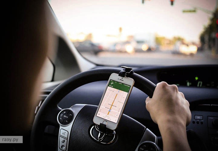 The smartphone can also be mounted on the steering wheel
Photo onfancy.com
It's also worth thinking about how long the device you choose can work offline. If the battery of the navigator allows it to function without recharging for 2-3 hours, then the always-on screen of a smartphone operating in navigation mode will “land” the gadget much earlier.
|
GPS navigator |
Smartphone |
||
|
pros |
Minuses |
pros |
Minuses |
|
Location tracking reliability |
The relatively high cost of such a monotasking device |
Easily available and cheap (often free) cards |
Battery life (when you turn on navigation applications, the smartphone begins to burn calories at breakneck speed) |
|
Structural strength |
Low display resolution, which sometimes makes reading cards quite difficult |
Size (many users view the relatively small smartphone screen as a disadvantage) |
Navigation may be interrupted by a call |
|
Typically, navigator displays are equipped with an anti-glare coating, which makes using the device more comfortable. |
Even today, many navigators do not have an Internet connection. |
Regular updates of mapping software (there is no need to connect the gadget to a desktop computer to “upload” updated data) |
Dependency on cellular signal |
|
Kit includes windshield mount and car charger |
Always with you, so it doesn't matter whose car you're in |
||
|
Good battery capacity |
Possibility to access the Internet at any time |
||
|
Optimal display size for card reading |
High performance indicators To summarize, it must be said that neither a smartphone nor a GPS navigator can clearly be called the winner of this debate. Each of them has its own advantages and disadvantages. And your decision will depend on many factors, including the condition family budget, habits, preferences and even mood. But there is one main question, to which every motorist must find the answer. Or rather, two interpretations of this question. First, decide whether you need a navigator if the phone you already have has the same functions? Second, consider whether a highly targeted device is always more reliable and understandable. After all, a cupcake can be baked in the microwave, but a bread maker will cope with this task much better. Wish you wise choice and error-free navigation! | ||
Ten years ago GPS system in our country they were used only by tourists and truck drivers who often made flights abroad. Nowadays, devices that can use the global positioning system (this is what the abbreviation stands for) are in the pocket of every second person - we are talking about modern smartphones. In addition, tablet PCs, which are also often equipped with satellite receivers, have become fashionable relatively recently. So is it worth purchasing a specialized car navigator, if you can use an alternative device that can perform dozens of other functions? tablet or navigator, which can be better said only after trying to use the technology in practice, which is what we will do.
Third participant
And we will start not with the mentioned devices, but with the third type of device - which has the most compact dimensions. In addition, its advantage over a conventional navigator is its versatility - you can make calls from such a device, use it during periods of rest, visiting interesting pages on the Internet or launching various applications, and e-books. However, the advantages of a smartphone are limited to versatility and ease of transportation due to its compact dimensions.
The first mentioned advantage also turns out to be the most significant disadvantage of this type of device.- to discern any details on its screen, you have to long time look closely, distracted from the road, or stop altogether. Of course, you can attach your smartphone or dashboard using a specialized retainer, but this will not fundamentally change the situation. You will also have to look for a car charger that can operate from a 12-volt outlet, since the use of satellite receivers quickly drains the battery of the electronic device - and the cost of such accessories for new smartphone models can be simply exorbitant.
The smartphone screen produces very strong glare on sunlight, and also does not always rationally choose the brightness level when changing outdoor lighting. Also, in comparison with the navigator, it has less power, as well as its location is far from optimal. In practice, this means that the device will constantly lose connection with satellites when you drive under bridges or drive past tall buildings, as well as cross hilly or high mountain areas.
Video on how to use a smartphone as a navigator and video recorder:
Maximum size
Using a tablet as a navigator, you will encounter the opposite extreme, represented in overly large size screen. In most passenger cars, it will simply block a considerable part of the view, reducing the ease of driving and significantly reducing road safety. The tablet dimensions are only for cars such as:
- Commercial vehicles(including long-haul trucks, buses, light delivery vehicles,);
- Large SUVs;
- Crossovers of medium and large class.

If you have already managed to adapt the tablet for use in a car, then you will be able to see the smallest details of the map, as well as receive real-time information about traffic jams via the mobile Internet - this is a premium function.
By the way, adapting a tablet for convenient use will not be as convenient as it seems - clamps and other supporting devices are still extremely rare on the open market, so most owners of such devices unleash their engineering genius and begin making supports and stands themselves. Just like for a smartphone, it will be difficult for a tablet to find a special car charger that allows you to connect it to an on-board 12-volt power supply. However, the cost is sometimes very high and may require you to spend a lot of money. If you buy a fairly expensive tablet from a well-known brand, it will be equipped with a fairly powerful battery that will last for 12–18 hours of use - in other cases autonomous operation will be completely impossible.
Video about using a tablet in a car:
Of course, the tablet can be used to browse the Internet, as well as to quickly install a variety of applications, including entertainment programs. However, its main disadvantage compared to full-fledged navigators and smartphones is the lack of pre-installed ones, which will have to be purchased for 1000–3500 rubles. Also, tablets have adopted another drawback from smartphones, which is the mediocre reception of the satellite signal in the presence of any interference.
Classics of the genre
Despite the ability to use a navigator program for a tablet, classic devices that indicate the way are still widely represented on the electronics market. Their main advantage is optimal selection screen diagonal, which does not interfere with the view and does not force you to stop to look at the details of the map. Also, the screen of navigators is usually covered with a transparent anti-glare material, which does not allow the sun's rays to reflect from the device, significantly reducing the quality of the visible image.
It’s also worth saying that in this case you definitely won’t have to purchase additional electronic cards or other software. Moreover, most manufacturers provide free access to updates for a certain time or even the entire period of operation of the navigator. Thrifty people will also be pleased, which for high-end premium navigators is equal to the same indicator as an average smartphone or inexpensive tablet. The device always includes a charger that connects to the car’s on-board network, so you don’t have to look for additional accessories.
It is clear that the navigator is designed primarily to indicate the path, so the quality of communication with satellites for this device will always be maximum due to the ideal location and power of the antenna. Consequently, you will not get lost either in the forest, or built up with high-rise buildings, or even high in the mountains. Modern devices Also, in many cases, they are equipped with built-in modules that allow you to connect to the Internet, which allows them to bridge the gap with tablets and smartphones, which can receive information about traffic jams in real time.
Of course, the navigator is not suitable for accessing the Internet for entertainment purposes, and will also require you to have the necessary skills to install additional applications. However, ask yourself how often you will use games or e-books on a device that you purchased solely for use in the car. At the same time, some manufacturers offer a solution to even this minor problem through the use of a device such as a navigator with tablet function.
Video on how to choose a GPS navigator for a car:
Depending on the basis on which it is built, such a device may have individual characteristics. In particular, devices based on operating system Android are more demanding on system resources, and, therefore, have a high cost. However, these navigators will give you the opportunity to quickly get used to managing all their functions, and will also allow you to quickly install any applications without using any professional knowledge. Models based on Windows CE are usually cheaper, but require a long time to master and replenish the software base. However, only such navigators will give you the opportunity to work in conjunction with other devices - for example, with a DVR and.
Each has its own advantages
Of course, the navigator has the largest number positive traits, if we evaluate it as a device for indicating the path when driving in a car - however, this does not mean that it is a non-alternative device. In particular, tablets and smartphones are most often used by those people who bought them for another reason and now just want to learn a new one useful function. A smartphone will be most useful if you use navigation extremely rarely and are willing to put up with the inconvenience a couple of times a year so as not to spend money on a new one. electronic device. A tablet is more efficient, however, its everyday use will be inconvenient, especially if you are the owner. But a specialized navigator is ideal for those who cannot imagine traveling without such an assistant.
The best prices and conditions for the purchase of new cars
Credit 4.5% / Installments / Trade-in / 95% approvals / Gifts in the salonMas Motors
Guys, I already wrote that my friends are going to Europe by car and bought a DVR (read the review here) and a navigator, I’ll definitely take it from them before the trip for testing. But I had this question - why buy if you have a phone? You know, I really thought about this question and it turns out that it makes sense. Read my thoughts...
In this article I will try to compare two “opposing” directions. On the one hand, these are phones and tablets (mobile devices that are always nearby), on the other hand, these are stationary navigators; many believe that their age is ending! But it seems to me that this is not entirely true. Let's start, perhaps, with phones and tablets.
Phones - tablets
There is nothing special to write about here. Of course now android phone, namely, these are what my friends have, a bunch of different navigation software, ranging from the same “NAVITEL” to various Yandex and Google maps and navigators (also on Apple and Windows).

On the one hand, this is certainly pleasing - it’s convenient, what can I say, I just activated “geodata” (GPS) on my phone and plotted the desired route. For a city, this is sometimes a salvation, especially if you are in a foreign city.

That is, the absolute plus is that the phone is always at hand, but is it so great compared to a separate device, I mean with a stationary navigator?
Navigator
You know, I always watch taxi drivers, because they are the most professional drivers of all. They work on cars for a very long period of time, know everyone and everything about the structure of a car, can carry on a conversation, always have the latest information in their city, in in general people- “hardened” (experienced). So, 90% of taxi drivers always have a stationary navigator, and not on their phone or tablet.
Only 5% have it on mobile devices, but why? There is a completely reasonable explanation for this. So I picked up a few points:
1) Price. If we talk about cost, it turns out that the price of the navigator is slightly more than the price of the navigation program itself. That is, if you buy the program locally on your phone, then the price turns out to be around 1800 rubles only for maps of Russia + more cards of the country you need, another 800 rubles. And if you are going to Finland. Then you need: 1800 rubles (Russia) + 800 rubles (Finland) = 2600 rubles. While the navigator itself with all the maps will cost about 2,900 rubles. Do you feel the difference?
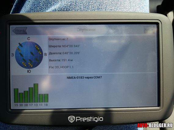
2) Satellites. One of the most important points is working with satellites, that is, many mobile devices have a “positioning” function (GPS), but it works via the Internet. But there may not be a pure GPS. Also, the operation of “autonomous” navigation systems can be difficult, because the processor is poorly optimized, the main power is “gobbled up” by others mobile applications, of which there can be a lot, so the navigation will be “side-by-side”.
![]()
Therefore, slowdowns and freezes may occur here, especially on phones and tablets with low RAM. ON navigators, all the main power is given to the main task - GPS, and therefore the search for satellites and positioning on the ground will go faster.
3) Additional traffic. Follows from the second point. It's no secret that the phone can download various data, for example about traffic jams (and the maps themselves), via the Internet. Thus, if you go to a neighboring region (and even more so to another country), you can run into “wild roaming”, the money will simply fly away in one go. Of course, you can turn off the Internet, but as a rule, many people simply forget to do this, and when they come to their senses it’s too late. So for navigators mobile internet- Hardly ever. Now, of course, models with 3G are appearing, but buying a separate SIM card is not always advisable. This will save you from unnecessary expenses.
4) Convenience. If the navigator is turned on and the phone rings, then you need to plot the route again. As a rule, on some “weak” models the program closes altogether, and you will need to start again. With all that it implies, and this is not good. What if they call you every few minutes? You will have to constantly “tug” the program!
5) Equipment. As a rule, navigators are already designed for placement on a car, so they come with all kinds of mounts, on the windshield or on the front panel. Whereas for a phone or tablet, you need to buy them in addition, and normal ones are not cheap at all.

6) Resource. As a rule, phones are not designed to run navigation programs for many hours. They overheat, causing the batteries to swell (tested on myself). As the manufacturers recommend, continuous operation can be for 30 minutes, no more! What if you are traveling to another city? YES, and if your battery dies, how much will a new one cost, and if you have some kind of “top” model with a non-separable case? There, one job will cost around 1500 - 2000 rubles + the price of the battery itself. So you need to think about when to force your phone or tablet like this.
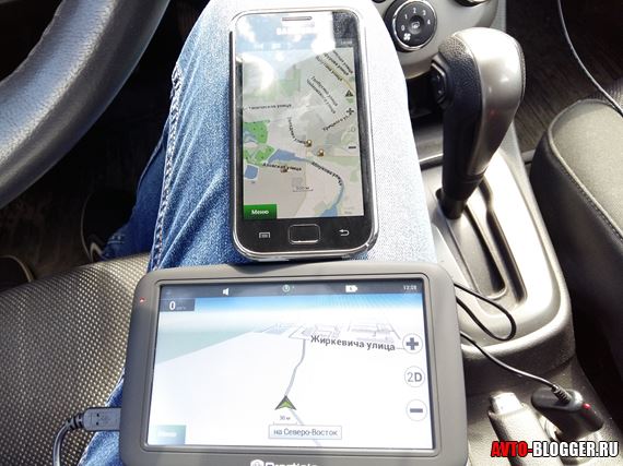
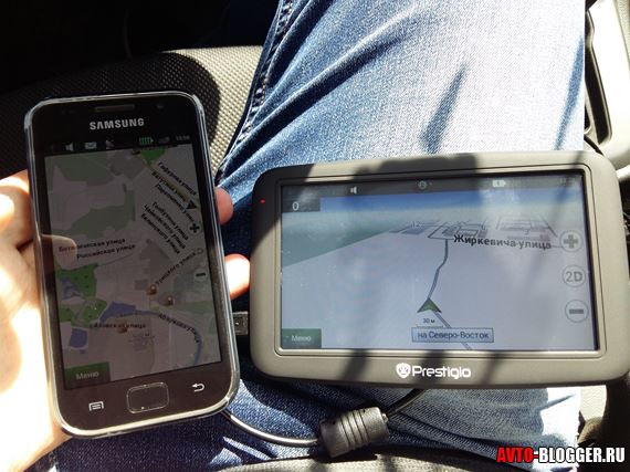
7) Screen. Nowadays, navigators mostly have a 5-7 inch display, the resolution may be different, this is not the point - but it is made almost like a square (or a non-elongated rectangle) - for me personally the perception is better. Phones also have a 5-inch display, but they are usually “elongated,” which impairs the perception of maps.
8) Multimedia. Well, probably the last thing - many people think that navigators are “stupid” devices that are designed only for navigation (although it seems to me that nothing more is needed). But this is not always correct - guys, modern navigators, especially on Android, can do whatever you say, they can view videos and photos, there are also browsers, WIFI, etc. Although I emphasize once again that this is not necessary at all! But it's worth noting.
Now a small video version
As you can see, navigators are superior to mobile devices in their functions. All because they are “tailored” specifically to one “positioning” function (GPS). YES, and the cost of such devices is not so high when compared with “top” mobile devices; sometimes it will be more expensive to buy cards for your phone! So they have a place, I advise everyone to read a review about a friend’s navigator soon. So subscribe.
That's all, sincerely your AUTOBLOGGER.
Using a tablet or smartphone as a navigation device GPS good solution.
These versatile devices allow you to perform a number of popular tasks.
For example: browsing the web, listening to music, watching a movie, reading e-books or have fun with games.
Nowadays, they can also often be found in cars, where they play a navigation role.
Tablet and smartphone - pros and cons
Lots of additional multimedia features.Possibility to choose the best navigation applications - in case of dissatisfaction, you can replace it at any time.
Ability to use free applications.
Higher price.
Separate GPS navigator - pros and cons
Cheaper than a tabletGuarantee.
Increased efficiency of the GPS module.
Limited functionality.
Usually able to use software from only one manufacturer.
One advantage, but also a disadvantage, in both cases can be the screen size.
In standard cars, a display that is too large may limit your field of view, while a display that is too small may prevent you from using the touchscreen and seeing route details.
When deciding on a tablet or smartphone that will act as navigation, pay attention to whether it is equipped with a GPS module.
This is really the only requirement for a mobile device, although most models available on the market have GPS installed and do not always work correctly, especially in non- expensive devices.
To save money, manufacturers choose lousy receivers that can only find two or three satellites.
The best tablets and smartphones are more expensive and can find at least 8-10 satellites under the same conditions.
So before making your final choice, you should test how the device works as a car navigation.
Some devices, in addition to the traditional GPS module, are also equipped with the GLONASS system, then navigation accuracy improves.
A-GPS navigator for smartphones and tablets
In some models of tablets and smartphones, in addition to the GPS module, A-GPS is installed.
This receiver allows you to set your current position using base stations.
A-GPS gets to its original position faster, but is less accurate. Its accuracy depends primarily on the density of base stations. Therefore, it is often an addition to a regular GPS receiver.
Maps for navigators in smartphones and tablets
Another very important element equipment is the ability to access the network.
For a tablet or smartphone to operate independently, it must be equipped with a 3G modem that allows you to connect to the Internet.
Why is it important? When free applications(and several paid ones) may require constant Internet access.
This happens in case free cards provided by Google. The Internet is also useful for other, additional data downloaded using the software.
In the case of navigation, information about traffic jams, speed cameras, traffic accidents can be obtained, all in real time.
This allows you to quickly reach your destination by optimal choice route.
Some apps allow you to memorize a section of the map and then read it offline or simply download the maps.
Installation of smartphones and tablets
To be able to comfortably use a tablet or smartphone as navigation, you need to purchase a special car mount that is matched to the size of the device.
Charging smartphones and tablets
Owners of tablets or smartphones and users of traditional navigation cannot count on too long battery life.
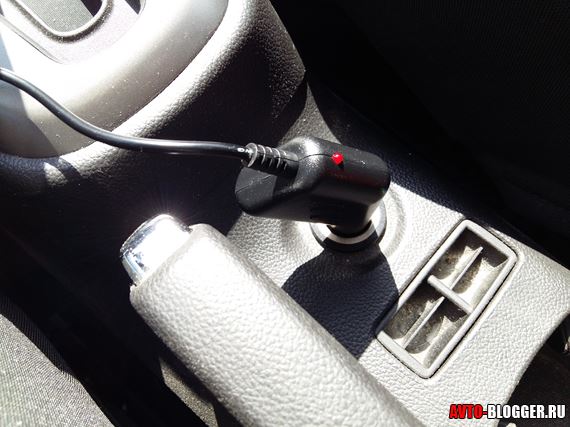
Therefore, in the case of the former, be sure to purchase a car charger that connects to the cigarette lighter.
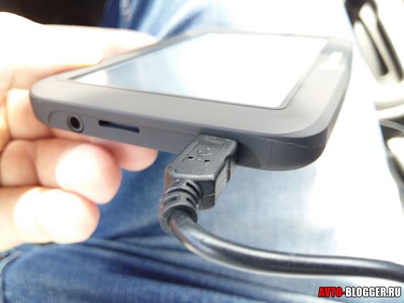
However, not every tablet can be charged using USB. In this case, you must purchase additional accessories from the device manufacturer.
When choosing, you should also consider the screen size, which should not exceed 7-8 inches.
This optimal size, which does not obscure half of the glass in the car, and at the same time will be convenient when used outside the car. Good luck.