Navigators supporting Glonass and GPS. The best navigators with Glonass support
Perhaps this article should start with a popular explanation of the GLONASS system itself. What does the average navigator user know about this system? Yes, actually, nothing important. Well, some kind of thing, you often hear about it, and usually you only hear flattering reviews. But, if you look at it, every third car owner has a dual-system navigator - GLONASS/GPS. This is how it often happens - we buy something, but we don’t really try to know why this or that function is in the gadget.
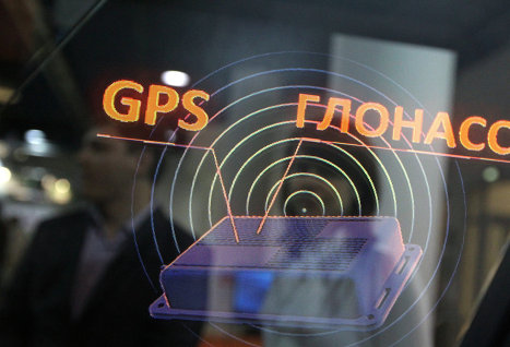
Get to the point. Actually, what is GLONASS?
The Global Navigation Satellite System is its full name. This is a Russian system, or rather, even a Soviet one. At the moment, this is one of two fully functioning global navigation systems. And, of course, the closest competitor to this system is the GPS satellite system.
What’s most interesting is that both systems are not without mistakes, which allows GLONASS and GPS to compete quite successfully with each other long time. Of course, the GPS system receives much more funding from its government, which primarily affects its popularity.
However, GLONASS has its own trump cards up its sleeve. One of the trump cards is that the movement of the system’s satellites does not resonate with rotation Globe, unlike its competitor, this factor provides GLONASS with higher stability.
In order to confidently determine coordinates, the system needs to keep 4 or more satellites under control; with fewer of them, calculating the exact coordinates of an object becomes difficult. At the moment, GPS is the leader in the accuracy of determining coordinates, but GLONASS is practically not inferior to its competitor’s indicators and in the future their accuracy is planned to increase several times.
It turns out that both GLONASS and GPS themselves are very accurate and stable satellite systems. However, the world has stepped even further, combining two satellite systems into one device, due to which it was possible to significantly improve the accuracy of coordinate determination.
Myths about dual-system navigators
On popular automobile forums you constantly notice questions about the advantages of such a hybrid, so let us also look into these very advantages. Let's take urban conditions as a basis; they are much more difficult for systems than ordinary highways and highways.
- There is still a myth that dual-system devices take much longer to load during a cold start than single-system devices. In fact, we do not observe a significant difference in loading speed when it comes to dual-system and GPS separately, but it is known that GLONASS itself loads much faster than its competitor.
- Driving along wide streets does not create problems for either a dual-system or a single-system vehicle. But in high-rise areas, we can see the full power of the dual-system device, with virtually no errors, while GPS continually guides us across lawns and through buildings.
- As for tunnels and underground parking lots, then the single-system system has much more problems. The dual-system system does not overcome such a distance without problems, but it searches for satellites faster, so it leaves “dark” zones much faster; sometimes GLONASS/GPS manages to catch satellites even in small gaps in tunnels.
- As for the number of satellites, where GPS sees 2-3 satellites, GLONASS/GPS sees them at least 2 times more, usually this figure is 9-10 satellites.
- Another myth allegedly states that dual-system systems have much higher energy consumption. And this is also nonsense, with the same battery capacities, two and single-system devices will be discharged almost equally, the difference will be 10-20 minutes.
Should I take the “dual-system” or not?
If there is a financial opportunity to purchase such a device, then my answer to you is definitely to buy it!
As we could see above, dual-system devices not only do a better job of indicating the route, but are also not inferior in speed and energy consumption to single-system devices.
Therefore, if possible, purchase GLONASS/GPS navigators; you will benefit in all respects. Another thing is that the choice of such models is not as extensive as conventional GPS models; after all, combo gadgets are not so popular, and many simply do not see any reason to buy such gadgets when they are satisfied with ordinary ones.
Well, if you operate the navigator in difficult conditions (multi-story sectors, tunnels and other factors that interfere with navigation accuracy), then you should definitely take a closer look at dual-system systems.
Well, what to choose - for you we have compiled a sort of mini-rating of good devices that people respond positively to.
The sweetest thing - TOP 5 GLONASS/GPS navigators
Unfortunately, to this day, dual-system navigators have not yet received the attention they deserve. Therefore, the situation with such devices on the gadget market is quite meager.
Of course, there are some very outstanding models. But they are typical riding horses, they do their job perfectly well, but they lack the idea that has been evident for a long time - the device should be able to do everything and even more. But we buy a navigator specifically for the navigator function? And for everything else there are tablet PCs and smartphones.
Lexand SG-615 HD
So, the first device in our top list is the cheap, and also high-quality Lexand SG-615 HD. The price of the device is more than attractive: 3,750 rubles, everyone can afford it. And everyone can be sure that this device justifies its cost twice.

— Of course, the internal hardware of the device cannot be compared with the flagships of the smartphone industry, but the gadget has enough power for its needs.
— The 5-inch screen has a good resolution, although sometimes the brightness is not enough.
- Old, but still good operating system- WinCE 6.0.
— The built-in memory is 4 GB, which is also enough, and if desired, it can be expanded.
— Licensed Navitel is already preinstalled on board.
— The device itself looks elegant, the metal edging gives a pleasant shine, so the device will only decorate the car interior with its appearance. As for the menu, there is nothing to complain about here either, everything is intuitive, colorful and bright.
As for user reviews. Everyone agrees on the following: this model copes well with the main function, as for secondary functions, they fly by. It will not be possible to show your child the collection of the animated series “Masha and the Bear” on the road.
Shturmann Link 500GL
TOP participant number 2 is a more expensive model, but also cooler. Its cost is 5,600 rubles, which seems a little overpriced, because the characteristics of the device are almost identical to the previous model, but it’s all about the software, gentlemen.
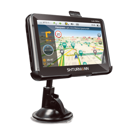
— The navigator screen is anti-glare, 5 inches diagonal.
— The operating system is also manufactured by Microsoft.
— Navigation software provided by Shturmann with Navteq maps of Ukraine, Russia and also Finland.
— What can be distinguished from the features of the device? The presence of a slot for a SIM card (a SIM card, among other things, allows you to load traffic jams).
— The increased strength of the body also speaks for itself. There is Internet, which means you can use On-line traffic jams from the Yandex company and Yamas from the RosYama company in full swing. What’s very nice is that this navigator also copes well with phone functions.
What does the user say about the device? The device suits everyone, but many complain about the satellite software from Shturmann itself, saying it freezes. But they cope with the problem simply - replace it with the usual Navitel. Otherwise there are no complaints.
Oysters Chrome 5500 3G
The third device in a row is the Chrom 5500, it costs well, looks nice and works great. It would be a sin not to pay 6,000 rubles for such a thing. Android is worth it))

— The filling of this device looks more advanced, I’ll say right away that the child will be able to watch cartoons.
— The system is modern – Android. The versions are not the latest, but toys and programs from the local online store come without any problems.
— If you have a USB adapter, the device will happily work with an external 3G modem, Flesh drive and other HID gadgets.
— The gadget is based on Navitel and, I’ll tell you a secret, Navitel on Android is updated much more often.
— There is almost a record number of preinstalled maps: Asia, Europe, America and all of Russia. In general, this device is created for everyone's enjoyment and it succeeds.
People are happy with the navigator, they say it’s fast (if you don’t overload it) and it picks up satellites well, but the battery is weak, but you can live with that. As for me, this is the best option for those who want to have everything at once - the navigator is powerful, it costs a modern Android, which means a lot of possibilities, plus two positioning systems. And in terms of money, most Russian car enthusiasts can afford the gadget.
Garmin Nuvi 2495LT and Nuvi 2595LMT Europe
I decided to talk about the latest TOP participants at the same time. These are models from a well-known company that strives not for its beauty and bells and whistles, but for its best quality!

— These are navigators for advanced people and they cost advanced 10,300 rubles for the 2495LT model and 13,200 rubles for the 2595LMT.
— In terms of software, the devices are not significant, but they are different from each other; as for the hardware, the differences are barely distinguishable at all.
— Their main feature is excellent quality of signal reception from satellites, excellent accuracy and excellent satellite software - exactly what an ideal navigator needs.
The cheaper model is specialized for our local places and has City Navigator Russia 2014.40 with installed maps of Ukraine, Russia, Abkhazia, and Belarus. In addition to the navigation itself, there are also nice things: dual screen orientation, Yandex points, a player for audiobooks, Lane assist and trafficTrends, and also voice control.
The higher-cost model is focused on Europe, which is why the maps there are European and constantly updated. There are also add-ons that will help you not get lost in an unknown country, which will help you out in any situation.
Whatever you say, Garmin products are the best among navigators. Happy owners rejoice for life, because the devices are guaranteed for 5 years and there are no freezes for you, and no problems with updates and other things. In general, like in dreams.
You might be interested.
It is believed that navigators with GLONASS/GPS have a number of advantages in accuracy and stability over conventional GPS navigators. To find out how true this is, we conducted a test drive of navigators with GPS and GLONASS/GPS in urban conditions.
City:
Navigator models
Lexand ST-5650 PRO HD (GPS only), based on the SiRF Atlas V chipset.
Lexand SG-555 (GLONASS/GPS), based on the MStar chipset.
Both navigators have the Navitel 5 program installed.
Subject of testing
“Cold start” time (from turning on the device to determining the location), stability of navigation, its accuracy and duration battery life navigator.
Test conditions
The gadgets are not connected to the cigarette lighter, but are installed on the windshield next to each other. In the navigation program, the “snap to road” function is disabled - it would automatically “pull” the car displayed on the map to the nearest road and would make it impossible for us to see the difference in the accuracy of the coordinates.
Cold start
Both navigators were turned on in an open parking lot, at a sufficient distance from houses and trees, which theoretically could interfere with satellite signal reception. The “cold start” time was approximately the same – about four minutes for both devices.
On the wide street
When driving along Rusakovskaya Street, no problems were noticed with either the GPS navigator or its dual-system colleague. Except that on the model that only works with GPS, the car periodically “skidded” either onto the tram rails or onto the sidewalk.
Multi-storey building area
In the area of high-rise buildings at the corner of Rusakovskaya and the Third Transport Ring, periodic errors occurred on both devices. GLONASS/GPS sometimes got into the lawns, but quickly corrected the errors. The GPS navigator once indicated that a car had driven through the house.
Underground parking
The underground parking lot "Auchan-Sokolniki" was chosen as a testing site. Here GLONASS/GPS showed clear superiority for the first time. In the narrow passage between Auchan and the wall separating the territory from railway, the dual-system navigator determined the location without deviations. Under the same conditions, a GPS navigator displayed the car either on the roof of a hypermarket or on the railway tracks.
Once under the roof, GLONASS/GPS lost contact only at the end of the parking ramp, and the GPS navigator stopped working immediately. The same is true when traveling: the GPS navigator picked up the satellite signal only when it was in the open air, lagging behind the dual-system model by 5-10 seconds.
Tunnels
When entering the tunnel under Taganskaya Square, both navigators lost their satellites at the same time. But in the place where there is a gap in the arch (approximately in the middle of the tunnel), GLONASS/GPS resumed operation for a while and found several satellites. The navigator with only GPS ignored the clearance and began to function only at the exit from the tunnel.
In the tunnel under Triumphal Square, both devices showed the same deviations and lost the signal at the same time.
High-rise development area
“Moscow City” turned out to be the only place visited during testing where the navigator was able to “see” more satellites GLONASS than GPS. Near the capital's skyscrapers, Lexand SG-555 received signals from seven Russian satellites and five American ones. Lexand ST-5650 PRO HD at some point displayed that we were somewhere on the roof of one of the buildings.
Number of satellites
During the GLONASS/GPS test, the navigator always displayed approximately 9-10 GPS satellites and only 2-3 GLONASS satellites. Many people mistakenly conclude that there are fewer GLONASS satellites or that they work worse. In fact, the navigation software settings are such that GPS is the main navigation system for the device by default, and the Russian constellation of satellites is an additional one. That is, GLONASS fills signal reception channels free from GPS.
Energy costs
The opinion that dual-system navigators consume more energy has not been confirmed. With the same battery capacity (950 mAh), the GPS navigator worked for 1 hour 20 minutes without recharging, the navigator with GLONASS/GPS - 1 hour 35 minutes.
Results
The results of the test are as follows: in most cases, a GPS navigator is sufficient for traveling in urban areas. But the fact that navigators with GLONASS/GPS in some cases work more accurately and reliably is a confirmed fact.
This article contains the best navigators that can be found on the market today. The main selection criteria was support for two navigation satellite systems GPS and GLONASS. Additional criteria included high-quality hardware for the navigator, the Android operating system, at least 512 MB of RAM and a 7” diagonal display. The Garmin Nuvi 2595LT is a minor exception, but for good reason.
Prology iMap-7700Tab

Design and materials. Prology iMap-7700Tab is made of plastic that is pleasant to the touch. On the side of the iMap-7700Tab there are power and volume buttons, which are very convenient to use. The navigator comes with a very convenient car bracket that confidently holds the gadget on the dashboard or glass (with the ability to adjust the distance from the glass).
Display. Prology iMap-7700Tab received a 7-inch display with a regular TFT matrix with a resolution of 1024 x 600. For its main purpose (high-quality display of the route on various maps), this display is more than enough.
Iron. The tablet runs on a dual-core processor with a frequency of 1 GHz based on the MediaTek MT8377 chip. The tablet's performance and reliable navigation will be ensured by 1 GB of RAM. The small amount of internal storage (8 GB) can be increased with a microSD memory card. It is important to note that with weak hardware for a tablet, the Prology iMap-7700Tab, as a navigator, will work for a long time due to a capacious 3000 mAh battery.
Software. Android 4.1 is installed on the navigator. It’s not even worth explaining why this OS is better than the notorious Windows CE 6.0. When turned on, among other things, an experienced user will probably notice the Navitel Navigator application icon. In addition to GPS satellites, the tablet also supports GLONASS satellites, which significantly increases signal stability and location accuracy. A cold start takes approximately 95 seconds, and subsequent hot starts take approx. 10 s. Switching between menu items occurs quickly, the navigator slows down slightly when working with maps in 3D mode. At the same time, the processor very quickly creates routes from one city to another or within a large metropolis.
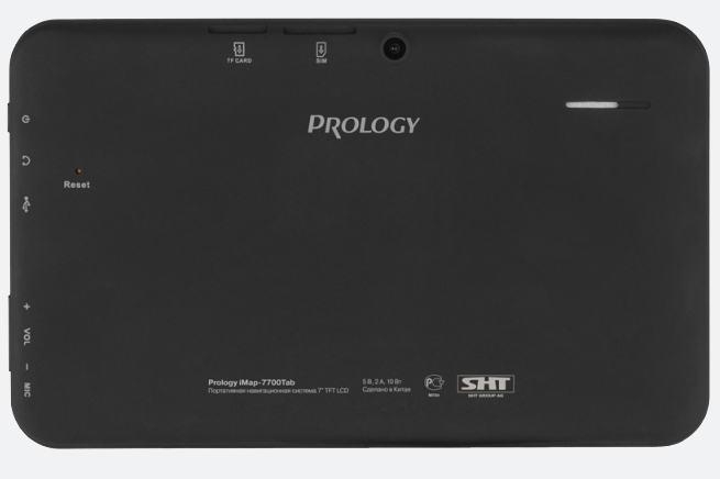
Maps of Russia, Ukraine, Belarus, Kazakhstan, Latvia, Lithuania, Estonia, Poland, Norway, Denmark, Sweden, and Finland are already preinstalled on the tablet. Of course, you can remove this navigator and install any other one, because Android capabilities allow this, if you wish.
Camera. iMap-7700Tab can also be used as a video recorder, thanks to the 2 MP rear camera. The recording quality is, of course, mediocre, but the savings Money obvious.
Bottom line. Prology iMap-7700Tab – very good car navigator with support for both navigation satellite systems. This device will serve its user faithfully for a long time.
Average price: 7,000 rub.
SeeMax Smart TG730

Design and materials. SeeMax Smart TG730 entered the market at the end of the fourth quarter of 2013 and still remains a very competitive gadget. Smart TG730 is made in plastic case with soft-touch coating and grooves for mounting on the back surface.
The navigator is mounted on the windshield. Not all users like this, but there is no other mount included with the Smart TG730.
Display. Smart TG730 has a 7-inch display (TN+Film) with a resolution of 1024 x 600. Color rendition is not entirely good, but it has large viewing angles, which is important. There is enough brightness to clearly distinguish images and text on the screen in very sunny weather. As with the models discussed above, this display is quite sufficient for navigation.
Iron. Smart TG730 is equipped with a dual-core processor with a frequency of 1.2 GHz based on the Allwinner A20 chip. In addition, the navigator has 1 GB of RAM and an 8 GB internal storage. The navigator operates for a long time on a single charge due to a capacious 3200 mAh battery.
Software. Android 4.2 is installed on the navigator with all the ensuing consequences, i.e. the user can install his favorite navigation software, listen to music and watch movies - in this regard, the Smart TG730 looks like a typical tablet. It is important to note that Smart TG730 supports two navigation systems: GPS and GLONASS. Both modules work simultaneously, which allows you to very quickly determine coordinates. A cold start takes 2 minutes, and subsequent hot starts take 5 seconds.
Camera. Smart TG730 has 2 cameras: a 2 MP rear camera and a 0.3 MP front camera. Of course, this navigator can also be used as a DVR.
Bottom line. SeeMax Smart TG730 is an excellent navigator. It quickly and accurately plots a route, very rarely loses satellites, and reports within 5 seconds if it has gone off route. It is worth noting that this device will replace as many as three gadgets in the user’s car: a GPS navigator, a video recorder and a simple tablet.
Average price: 5,700 rub.
Navitel NX7200HD Plus
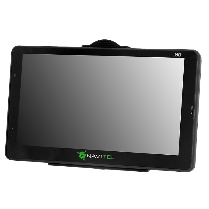
Design and materials. Navitel NX7200HD Plus is made in a plastic case with slightly cut corners. All buttons and interfaces are located conveniently for the user. Only the power button is a little narrow. In general, the navigator is light and compact.
Comes with good fastening with a hinge and a suction cup covered with a protective plastic cover. Due to this design, the user can rotate the device in all directions. The gadget sits securely in the mount and is held on the glass.
Display. Navitel NX7200HD Plus received a 7-inch display with a resolution of 800 × 480 pixels. The screen does not have any anti-glare coating, so on a bright sunny day it is difficult to see the images on the display.

Iron. The Navitel NX7200HD Plus navigator is equipped with a dual-core processor with a frequency of 1.2 GHz based on the RockChip RK2918 (Cortex-A8) chip. Performance will be ensured by 512 MB of RAM. The internal storage has a capacity of 8 GB (+microSD). In addition, the navigator is equipped with a 1500 mAh battery, which is enough for 2 hours of operation.
Software. Navitel NX7200HD Plus has Android 2.3.1 installed - an old version of this OS, but even this better than Windows CE 6.0 installed on most other navigators. The navigator is equipped with Navitel 7.5 with maps of Russia, Ukraine, Belarus, Kazakhstan and Finland, plus a small map of Europe. A cold start takes about 3 minutes, and subsequent hot starts take about 5-7 seconds. These results are slightly below average, but they are compensated for in other ways. Navitel NX7200HD Plus simultaneously supports both navigation systems: GPS and GLONASS - this gives a much more stable signal and more accurate determination of coordinates.
Bottom line. Despite the old version of Android and not very powerful hardware, the Navitel NX7200HD Plus navigator copes with its functions very well. In addition, at the user's discretion, you can install any other navigation software.
Average price: 6,000 rub.
Garmin Nuvi 2595LT

Design and materials. The design of the Garmin Nuvi 2595 is quite typical for navigators: a rectangular body with rounded corners. The navigator, due to the small display, turned out to be light and convenient. Although the body is a little thicker than users are used to seeing in navigators.
The Nuvi 2595 navigator mounts are one of the best on the market. The compact bracket takes up little space and is well mounted on a hinge, which allows you to rotate the navigator without inconvenient adjustment screws.
Display. Garmin Nuvi 2595LT has a small display with a diagonal of 5” (480 × 272). The display has a large reserve of brightness and has an anti-reflective coating, so the cards are clearly visible in any lighting.
Iron. The hardware of the Garmin Nuvi 2595LT navigator is shrouded in mystery and darkness. However, it is worth saying that the navigator works great under the heaviest loads. But it is known that it has an internal storage capacity of 4 GB, which can be expanded with a microSD memory card.

Software. Garmin uses its own operating system and navigation software in the Nuvi 2595LT navigator. The process of updating maps is somewhat inconvenient. You have to install a special Garmin Express program on your personal computer. The navigator's cold start time takes 50 seconds, and subsequent hot starts take 2 seconds. These results are some of the best among today's navigators. The route is laid out quickly and efficiently. It is worth saying that Garmin Nuvi 2595LT supports both navigation systems.
Hybrid GLONASS/GPS navigators are devices capable of working with both the American and Russian satellite systems. The first mass-produced models of this type were Lexand and Explay navigators. Following them, almost all major brands in the world hastened to acquire their own “dual-system systems”. Russian market. According to SmartMarketing, from May to December 2011, about 100 thousand such devices were sold in our country - this is approximately 6.6% of the total market. And in the first half of 2012, about 26,000 thousand have already been sold.
Why do users need hybrid navigators? It’s simple: such devices demonstrate more reliable signal reception,, as a rule, have a shorter cold start time, and more accurately determine coordinates. In addition, they will not fail in the “concrete jungle” - in the conditions of modern cities, where high-rise buildings obscure a significant part of the sky. Then there may not be enough GPS satellites in the reception area to operate, and accurate readings from the navigator will be provided by data from GLONASS satellites. And when entering an underground parking lot or into a tunnel, the dual-system navigator will hold the signal longer, and when leaving, it will establish a connection faster. At the same time, we want to immediately dispel the misconception that exists among users that a dual-system navigator can use readings from 2 satellites of one system and 2 satellites of another to plot coordinates. Unfortunately, this is not yet possible.
LEXAND SG-615 HD – GLONASS/GPS car navigator, test
The LEXAND brand has perhaps the widest range of GPS navigators on the market. The hero of today's test is one of the many new products, LEXAND, which works simultaneously with both GPS and GLONASS.
TEST RESULTS
DESIGN FEATURES: the model in question has a rather thin body, with a silver frame around the perimeter of the front side. The main material of the back cover is black soft-touch plastic. It was not possible to detect any play or creaks; even with strong compression, the body remains solid.
The windshield mount on the LEXAND SG-615 HD is standard for this brand and is not particularly remarkable. There is absolutely nothing to complain about: the suction cup is easily attached to the glass, and the holder is freely adjustable horizontally and vertically. Having secured the LEXAND SG-615 HD, we tried to use the charger, whose wire reached the cigarette lighter with a good margin. Let us immediately note that the built-in 950 mAh battery lasts for at least two hours of operation, depending on the screen brightness level.
On the left side of the navigator there are the main connectors: miniUSB, a 3.5 mm headset output and a microSD memory card slot. The top end contains an on/off button, a small speaker slot and a recess for a stylus with the pointer itself - it is best suited for controlling a resistive screen.
The hardware platform of the LEXAND SG-615 HD is the MStar ARM9 MSB2521 processor with a frequency of 500 MHz, which is a productive basis for
Windows Embedded CE 6.0. The amount of RAM is the usual 128 MB for navigators. 4 GB of internal space is allocated for data storage; memory cards up to 16 GB are additionally supported.
The 5-inch diagonal screen has a resolution of 800x480 pixels. This is the maximum value for such a diagonal in navigators, which is why the model is called HD. The display displays 65 thousand colors and is protected by anti-glare coating. In the sun I would like to see a brighter picture, but even with the available level the information is read normally.
FEATURES OF OPERATION: the navigation software included in the kit is the Navitel Navigator 5, which has long been familiar to us. In addition to it, you can install any other program and switch between them from the “Navigation Path” menu item. The general software shell of the navigator is equipped with large and extremely clear icons; it is difficult to get confused in the interface. LEXAND SG-615 HD is suitable as a video player, music player and photo frame. By the way, the model supports the FM transmitter function. It allows you to connect the navigator to the car's audio system, which has the most favorable effect on the quality and volume of the audio.
Now about the “delicious” part - the simultaneous operation of GLONASS and GPS. The time required to search for satellites in open areas was only a couple of seconds shorter compared to the single-system LEXAND STR-5350 HD. But in conditions where only small area sky, the difference is noticeable: when descending into an underground parking lot, GLONASS/GPS does not “lose” satellites longer, and when leaving, it “searches” for them faster. A similar situation occurs in tunnels.
To see the difference in the accuracy of determining the coordinates, I had to disable the function of linking to the road - automatic adjustment of the determined location. The difference was also revealed here: while GLONASS/GPS drove the car more or less accurately along the road (even jumping into the next lane and the side of the road 2-3 times), GPS managed to find the car on which the test was carried out three times on the roof of neighboring buildings.
ADVANTAGES: maximum stable signal reception due to simultaneous GPS operation and GLONASS. High-quality screen with anti-glare coating.
DISADVANTAGES: I would like to see a brighter screen, quieter speaker.
OVERALL RATING: Automotive LEXAND navigator The SG-615 HD fully justifies its price: it is a navigator with a good display, standard software and the highest possible signal reception stability in the most different conditions. GLONASS and GPS once again prove that they are not rivals, but complementary colleagues and comrades.
EXPLAY GN-530 - GLONASS/GPS car navigator with Bluetooth, test
TEST RESULTS
DESIGN FEATURES: the thickness of the GLONASS navigator Explay GN-530 case is one millimeter less than that of the Lexand SG-615 HD - 12 mm. The edges of the case are rounded, the right and left ends are slightly convex, the front panel is completely flat.
The Explay GN-530 is equipped with an MStar MSB2521A chip and an ARM9 processor with a frequency of 550 MHz. The volume of built-in memory is 4 GB, RAM is 128 MB.
The display size is 5 inches, resolution is only 480 by 272 pixels. Control is carried out via a touch screen, the only button is to turn on the power. Battery capacity 950 mAh.
The Explay GN-530 car GLONASS navigator is supplied in a cardboard-colored box, which contains the navigator itself, an disassembled car holder bracket, a car charger, a microUSB-USB cable for connecting to a computer and a documentation package. From the documents - user manuals for the device and for the Navitel navigation program, instructions for installing the holder, instructions for converting video files, plus a warranty card and a manufacturer’s business card with a hotline phone number.
The car holder is made on a silicone suction cup with a ball joint and is attached to the GLONASS navigator at three points. Since the Explay GN-530 weighs only 177g, this is enough for a secure grip. On the back side of the bracket there is a small telescopic stylus.
There is a speaker on the back of the navigator, and all connectors are on the left side: a microSD memory card slot, an LED indicator, a RESET button and a microUSB connector. Please note that the navigator supports cards with a capacity of up to 16 GB.
OPERATION FEATURES: all control of the Explay GN-530 car GLONASS navigator is performed from the touch screen, and the only button is needed only to turn it on and off. A stylus may be needed only if you need to precisely select a section of text, for example in a browser window.
The navigator OS is Windows CE 6.0 with a proprietary shell. The main menu consists of six large icon buttons: “Navigation”, “Bluetooth”, “GPS Info.”, “Books & Photos”, “Media Player”, “System”.
The Explay GN-530 has an FM transmitter, with which the navigator can broadcast sound to the car's audio system. There is no built-in GSM module in the Explay GN-530, but there is a Bluetooth module for connecting to a mobile phone to receive information about traffic jams and other useful data from the Internet. However, a very small percentage of people actually use such a system: firstly, not all phones are suitable (with the HTC One V, for example, the Explay GN-530 completely refused to connect, and there were no problems with the Nokia C3-05), but Secondly, the connection process is quite complicated.
Additional software features worth mentioning are viewing photos, playing music and video files, reading e-books, but before that they will have to be converted to TXT format.
NAVIGATION PROGRAM: GLONASS navigator Explay GN-530 is accompanied by the fifth version of the Navitel Navigator navigation program with maps of Russia. In addition to it, it is possible to install two more navigation products, for example, add iGO for traveling around Europe and CityGuide for using their original traffic jam service.
ADVANTAGES: presence of FM transmitter and Bluetooth module.
DISADVANTAGES: low display resolution, inconvenient placement of the stylus.
OVERALL RATING: the Explay GN-530 car GLONASS navigator is a compromise for those who are willing to sacrifice screen resolution for traffic information.
Prestigio GeoVision 5135 – GPS/GLONASS car navigator, test
TEST RESULTS
DESIGN FEATURES: the body of the GLONASS navigator Prestigio GeoVision 5135 is made in a modern style for navigators: a flat screen with a black frame, an aluminum strip along the perimeter. The back panel is made of Soft-Touch plastic. The thickness of the case is 12 mm, only in the place where the GLONASS module is located, it is 16 mm.
The connectors and buttons are located at the ends: on the top there is a power button, on the left there is mini-USB, a slot for microSD memory cards, and a 3.5 mm audio output. The speaker and reset button are on the rear panel.
The volume of RAM of Prestigio GeoVision 5135 is 128 MB, permanent memory is 2 GB. The processor clock frequency is 400 MHz, signals from satellites are received by the MStar MSB2320 chip. Despite the seemingly inferior processor frequency to previous participants, this navigator recalculated routes and loaded maps at approximately the same speed as others. This is a direct merit of the RockChip 2818 chipset, widely used in a wide variety of devices - from players to tablets and even some netbooks.
The display diagonal of the GLONASS navigator Prestigio GeoVision 5135 is 5 inches, resolution 480 by 272 pixels. Sensor type: resistive. The backlight is quite bright for use in any weather, and viewing angles are large.
It is commendable that the Prestigio GeoVision 5135 has a built-in Li-Pol battery with a capacity of 1200 mAh, providing 2-3 hours of battery life when playing music or video. When using the navigator for its intended purpose, the operating time is reduced to one and a half to two hours, since the operation of the hybrid GPS/GLONASS module is more energy-consuming than a standard GPS receiver.
The weight of the Prestigio GeoVision 5135 navigator is the largest in the review - 220 g.
OPERATING FEATURES: Microsoft Windows CE Core 5.0 is installed in the GLONASS navigator's memory. It supports major multimedia formats and text documents (TXT). The main menu is simple and concise, with only three items: “Navigation”, “GLONASS/GPS” and “Media”. The first one calls navigation program, the second clearly displays the operation of the satellite signal receiver. Well, in the latter the user will be able to find all other applications, namely an audio and video player, settings, a calculator and even several games, including even Tetris!
In cold start mode, it takes approximately 2-3 minutes to determine coordinates, and first the system catches signals GPS systems, and only then finds GLONASS. During a hot start, the opposite is true: first, signals from the Russian satellite group appear, and then from the American one, and this happens in about one minute.
NAVIGATION PROGRAM: like other participants in the review, Prestigio GeoVision 5135 comes with a pre-installed Navitel Navigator program, version 5, with maps of Russia.
The operating system gives the user the opportunity to install alternative shells and navigation systems, for which there are Windows CE versions, but for this you need to be embedded in the shell.
ADVANTAGES: design, viewing angles, screen backlight, the most affordable price from all three participants.
DISADVANTAGES: lack of any additional modules.
OVERALL RATING: the car GLONASS navigator Prestigio GeoVision 5135 showed good performance results, but it is somehow too simple, both in terms of technological filling and interface.
Prology iMap-527 MG – GPS/GLONASS car navigator, test
TEST RESULTS
DESIGN FEATURES: the design of the Prology iMap-527 MG car GLONASS navigator can be characterized by the following words: strict and laconic. The body is almost entirely made of gray plastic. The only exception is the black plastic insert that frames the screen. The corners are not the usual rounded, but beveled. On the top panel there is a power button, on the right side there is a 3.5 mm headphone jack, a memory card slot and a mini-USB port. On the back of the case there is a speaker and a Reset button.
The GLONASS navigator Prology iMap-527 MG has a processor with a clock frequency of 550 MHz. The volume of RAM is 128 MB, permanent memory is 4 GB. The navigator can work with microSD cards up to 8 GB, which you need to pay attention to when purchasing an expansion card. The resolution of the five-inch screen is only 480 by 272 pixels, which is small by today's standards.
The built-in 1100 mAh battery provides approximately 2.5 hours of battery life in player mode. Navigator weight 200 g.
The GLONASS navigator kit includes a windshield mount with a silicone suction cup that has already become standard. The tilt of the holder and its rotation are adjusted by two-axis hinge joints. A plastic bracket holds the navigator at three points in the middle of the device.
OPERATING FEATURES: The navigator is controlled by the Windows CE 6.0 operating system. It also provides multimedia capabilities: support for popular music and video formats. You can also read books on the GLONASS navigator Prology iMap-527 MG, but they must first be converted to UTF-8 encoding.
The main menu screen shows all operating modes of the device, which also includes displaying GPS/GLONASS data and launching multimedia files. Games can also be launched from the main screen, or you can start reading e-books. When you press the “GPS receiver” touch button in the main menu, data from satellites will be displayed on the screen.
In the "Multimedia" section, the user can play pre-loaded video and audio files. The “Settings” menu item allows you to adjust the device’s operating parameters (menu language, backlight brightness, sound volume), as well as specify the path to the navigation software and set the USB connection mode.
The presence of an FM transmitter can be added to the GLONASS asset of the Prology iMap-527 MG car navigator. It allows you to transmit sound to your car's audio system, which is much better than using the built-in speaker. In this mode, the role of the antenna is played by the charger wire.
NAVIGATION SOFTWARE: Prology iMap-527 MG comes with Navitel Navigator navigation software version 5 and the Commonwealth map package, which includes detailed maps Russia, Ukraine, Belarus and Kazakhstan (usually only Russia maps are supplied with navigators). Updates are available on the official website.
The ability to change the path to the navigation software in the settings allows you to use other programs on the navigator.
ADVANTAGES: comes with a package of “Commonwealth” cards, has an FM transmitter.
DISADVANTAGES: the information content of the screen in the sun deteriorates significantly, there is no possibility of using the traffic jam service.
OVERALL RATING: the car GLONASS navigator Prology iMap-527 MG is a device that is balanced in price and capabilities, which can be useful when traveling both around Russia and neighboring countries.
NAVITEL NX5100 – GPS/GLONASS car navigator, test
Everyone knows that NAVITEL is one of the leading developers of navigation packages for GPS / GLONASS devices and communicators. However, not everyone knows that the company also produces its own car navigators. It is the test of one of these devices that will be discussed. The hero of today's review will be the model NAVITEL navigator NX5100.
TEST RESULTS
DESIGN FEATURES: GLONASS car navigator NAVITEL NX5100 is made in a plastic case with dimensions 134x88x14mm. The display has a metal frame, which creates a feeling of high status and reliability of the device.
All interfaces and connectors are located at the ends of the navigator and are hidden under a rather thick plastic plug. Serious inconvenience in this work design feature does not contribute, but nevertheless, the meaning of such an engineering solution is not entirely clear.
Under the protective flap there is a slot for SD memory cards (on which map data is stored), a miniUSB connector, as well as a socket for A/V equipment, with which you can display images on an additional monitor. It should be noted that the audio output is made in the form of a 2.5mm mini Jack, and therefore headphones and other audio devices with a standard plug can be connected to the navigator only through a special adapter.
The display of the car GLONASS navigator NAVITEL NX5100 has a fairly solid diagonal (5 inches), as well as high level maximum permissible brightness, which allows you to easily distinguish the necessary objects on the displayed map. But at the same time, the display resolution is not very high - 480 x 272, and the horizontal viewing angle is quite small - the brightness decreases even with a slight rotation of the navigator.
The heart of the device is the SiRF Atlas-III microprocessor operating at a clock frequency of 372 MHz. As for the memory size, the device cannot boast of this indicator - 128 MB (ROM) and 64 MB (RAM), although this is quite enough for the full operation of the navigator. Separately, it is necessary to remember the built-in navigation chip SiRF Star III (20 channels), which has proven itself in a wide variety of navigators developed over the past few years.
Despite the fact that the main purpose of the navigator is to work in a car, where there is constant power supply from the on-board network, the device has a built-in battery with a capacity of 1100 mAh, which can provide about three hours of battery life.
To install the navigator, a traditional mounting kit is provided, consisting of a mechanical suction cup, an articulated stand and a compact stand. These accessories are made of high-strength plastic.
OPERATING FEATURES: The operating system of the NAVITEL NX5100 navigator is built on the Microsoft Windows CE 5.0 platform, which makes it fully compatible with almost any software that has been developed for this operating system.
From the GLONASS navigator display, all information is read quite quickly and easily. The attractive color scheme of the map, as well as the elaborate detailing of all its objects, deserves special praise.
In addition, the NX5100 model has the ability to update information about traffic jams. This operation is carried out using the Bluetooth option, which allows the navigator to connect to any communicator or phone and use them to access the worldwide network Internet.
From additional functions The NAVITEL NX5100 navigator should be noted: an MP3 player that allows you to create your own playlists, as well as a video player with a convenient interface with which you can view files in WMV, DivX, MPEG4, etc. formats. Moreover, the device can read test documents and flash animations.
NAVIGATION PROGRAM: The NAVITEL NX 5100 navigator operates on the basis of the Navitel Navigator mapping software. This navigation package contains all the main roads of all regions of Russia, as well as detailed maps with numbers residential buildings(more than 370 settlements). Not only street names with house numbers are displayed here, but also separately located buildings and buildings with fractional numbers. Moreover, on the map you can see other equally useful objects: road signs, police posts and radar installation points.
ADVANTAGES: high functionality, and a large number of additional options.
DISADVANTAGES: small horizontal viewing angle, low clock frequency.
OVERALL RATING: compared to its competitors, the NAVITEL NX5100 car GLONASS navigator has one of the best price/quality/functionality ratios. The navigation package that comes with the device will be an excellent assistant for those car enthusiasts who need maximum map detail.
GARMIN NUVI 2495 LT Glonass - car GPS/GLONASS navigator with Bluetooth, test
One of the latest and most popular models from GARMIN. The main advantages of this device include: highly detailed maps with an address search option, a voice prompt function, as well as a wide base of additional capabilities.
TEST RESULTS
DESIGN FEATURES: the GLONASS body of the GARMIN NUVI 2495 LT Glonass navigator is made of high-strength plastic and has dimensions of 137 x 83 x 15 mm. The device’s built-in screen with a working diagonal of 5 inches allows the user to change the orientation of the display, which allows the device to be used not only in a car, but also separately - when moving on foot. In addition, the navigator supports the Multi-Touch function, which greatly simplifies the process of working with displayed maps.
The volume of permanent memory in the GARMIN NUVI 2495 LT car navigator model is 4 GB, and the navigator has a slot for connecting an additional memory card in micro SD format. It should also be noted that it supports the Bluetooth function, with which you can easily exchange data with other electronic devices: computers, tablets, smartphones, etc. First of all, it is necessary to work with the Traffic Jams service. In this mode, the modem acts as mobile phone a user who contacts the server and then transmits data to the navigator via the Bluetooth protocol.
The navigator is powered via the built-in Li-Ion battery with a capacity of 1200 mAh or from the vehicle’s on-board network (from the cigarette lighter). In the case of power supply only from the battery, the operating time of the device reaches 4 hours. When the battery is completely discharged, it can be recharged using the included charger, or using the same cigarette lighter connector.
The weight of the GLONASS navigator GARMIN NUVI 2495 LT does not exceed 192 g.
OPERATION FEATURES: the car navigator uses software GARMIN Guidance 3.0, which, in addition to managing maps, has an expanded system for recording traffic jams, as well as the option of prompting for choosing the optimal row based on satellite images of the condition of roads and their interchanges. But with all the above advantages, the navigator has one very serious drawback - there is no numbering of houses and it is sometimes simply impossible to determine the correct location of the car.
As mentioned a little above, the GLONASS car navigator supports the Multi-Touch option. So, to control navigation, you just need to put two fingers on the touch display and move/spread them to determine the required scale. At the same time, thanks to a special orientation sensor, you can easily set the screen to horizontal or vertical, depending on the position of the navigator.
Separately, it should be said about the voice commands that this device supports. The list of functions displayed on the screen allows the driver to control the GARMIN NUVI 3490 navigator without taking his hands off the wheel, simply speaking the voice commands he requires to activate a particular function. It should be noted that voice control contains a so-called training protocol, with the help of which, over time, recognition of the owner’s voice will occur more efficiently and confidently. There are only two voice options - one is female (too high-pitched in our opinion), and the second is a calmer male one (it can only be set by switching to English operating mode).
In addition to navigation, the GARMIN NUVI 2495 LT model includes a large number of additional options, such as: a program for viewing JPEG files, an intuitive clock with automatic time zone detection, a currency conversion application, a calculator, etc. Moreover, the GLONASS navigator NUVI 2495 LT has the “Where am I?” function. thanks to which you can always determine your location, as well as get information about the nearest police stations, hospitals, gas stations. Although we have identified a certain flaw here: it is not possible to turn off the display, for example, of restaurants, leaving only gas stations. There is only one option - completely disable/enable additional objects on the map.
Of the undoubted advantages, it is necessary to note the photorealistic image of interchanges, which appears next to the map, and the function of selecting the optimal lane for their passage.
The kit includes maps of Russia, Belarus, Ukraine and Abkhazia, and the user has the opportunity to update maps for free every three months.
ADVANTAGES: Bluetooth function, simple controls, support for voice commands.
DISADVANTAGES: house numbers are not displayed when drawing maps, when you turn on the device, it constantly requires you to agree to the terms of use (takes extra time), the display only responds to your fingers.
OVERALL RATING: the car GLONASS navigator GARMIN NUVI 2495 LT is quite an acceptable option, although for the same amount you can purchase a more functional and modified device.